My friend and former coworker Ben left my company and is going to work at another, smaller company. He had a week off in between and decided to take 3/5ths of his children on a camping/geological odyssey to West Texas. He shared these plans with me and I agreed to make the three-hour drive from Midland down to Davis Mts State Park to join the trip for a day.
I left my house Tuesday morning in the MX-5 at 7:30am under overcast, spitting skies (top up). Inexplicably, I drove past all the gas stations in Midland although I noticed my gas gauge indicated about 1/8 tank. The car's tank holds a little over 10 gallons, although it does get 30 mpg. Down I-20 I went, with the feeling that I was on an adventure. Just past the last exit for Odessa, the low-fuel light came on. I decided to press on to Monahans, but was sweating it the entire way. On the way I spotted an exit and got off at the derelict and deserted "town" of Penwell, where there's plenty of oil but not much (or any) gasoline. I finally tanked up in downtown Monahans, which has seen better days, although it does have some thriving businesses (even besides the ever-present Sonic). Still, the closed-down shops along Main Street with the amateur murals on the sides are a little sad and make me wonder what Midland will come to, or any town "out here" with a one-track economy.
With a full tank of fuel and the top down (the skies had cleared), I could press on for Balmorhea. My dad and I stopped here briefly on my DIY move from Tucson to Houston in August 2007. We tried to camp but it was wet and smoky, and we pressed on to Fort Stockton where we got a hotel room that was even worse. This time around, I planned to stop in on this sleepy Tuesday morning and take a look at the place. Almost to Balmorhea, I got a text from Ben indicating that he and his crew had arrived at DMSP the evening before. I went from being a couple hours early to a couple late. I skipped BSP and headed straight for DMSP.
Just ten miles south of I-10, the Davis Mountains rise up a few thousand feet above the surroundings. The range is mostly volcanic, with lots of hoodoos and basaltic pillars across the face of the hillsides. The range reaches about 8200' ASL, but you'd never guess it driving through. Most of the range is around the 5000-6000' level, and pretty rounded and grassy, although the higher areas are covered with juniper shrublands. Turning south out of Balmorhea, and going uphill, I wound the MX-5 up to 111 mph (according to the GPS), a new speed record. The rest of the range didn't suit high-speed driving, but it was fun with sharp corners and some ups and downs, although the speed limit was a disappointing 55 mph.
 |
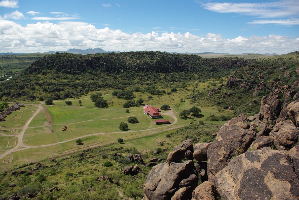
| Davis Mts State Park - looks a bit like NorCal |
 |
| Scenic view #994 |
 |
The Maz, resting
|
I've been this way before too. In January 2007, Sabkha and I stopped and camped at Davis Mts State Park on our way from Tucson to Houston for my internship at COP. There was a little snow on the ground that trip. I pulled into the park and eventually found Ben and his kidlets. We decided to hike from DMSP down to Fort Davis historical site. It's about 2.5 miles one way and brings you down from the heights of DMSP to the flats of the Fort, with some nice views along the way. Going down, each one of Ben's kids took their turns flinging themselves into a pokey desert plant. I had plenty of time to look around and snap photos as Ben did his Dad Duty by pulling out thorns, spikes, needles, burrs, hooks, splinters, etc., all the time consoling/cajoling his children. When they started to whine about the difficult hike and how tired they were, Ben spotted mountain lions creeping up from behind, ready to snack on any children who lagged. Or so he told his kids. It brought me back to my childhood hiking with my parents.
 |
| Fresh hiker |
 |
| Ben and the three-fifths |
 |
| View to the south from high point in DMSP |
|
|
The high desert of the Davis Mountains is very pretty but it is also full of bugs. I've noticed this in Midland too, which is full of bugs and spiders. Far more than I ever saw in Houston, which is subtropical and built on a swamp. Also, wayyyy more than I ever saw in Tucson. At every turn of the trail we saw different sorts of bugs and grasshoppers, and Ben's eldest daughter picked up every one, except the really mean-looking ones.
 |
| Wildlife |
 |
| Overlooking Fort Davis, and the eponymous town. |
Early on in our hike, the weather was quite pleasant. We watched as thunderstorm clouds built up over the main mass of the Davis Mts to the north. A quick check of the radar on my iPhone (so handy) showed that we had nothing to fear for the moment, as the precipitation was moving ENE. Down at the Fort, we found a spot in the grass with as few ants as possible and sat down to eat lunch in the shade of an Ogabooga tree. It was getting hot, and none of us were too keen to get up and walk around the fort, which was basically a giant, roasting-hot, bug-infested field with a few buildings scattered at each end. We roamed around for a while, vaguely interested, and eventually all ended up at the hospital, which sits up the canyon a little from the main Fort. The broad porches provide a good vantage point to view the lower Fort and the valley and mountains beyond. Ben commented how we could see the northern end of the Marathon Mountains just to the southeast.
 |
| Clouds forming to the north over the Davis Mts |
 |
| Looking down onto hospital at Ft Davis. Officer's houses visible at left of photo. |
 |
| House at Ft Davis |
Lethargic in the sun, we started the tramp back up the mountain. The temperature immediately increased about 20 degrees and the sun brightened noticeably. Everyone started to look a bit red and I felt burning on my bare legs as the sunshine fell onto them. Ben again cajoled, prodded and as a last resort carried his children up the hillside. We continued to see a variety of insect life. At the top of the ridge, about halfway back to the cars, we noticed the ridge to the north was shaded by thick, dark clouds that were, tantalizingly, moving in our direction -- but ever so slowly. Finally a few marginal tufts of cloud dimmed the intensity of the sun and we all uttered an "ahhhh". A few minutes last the clouds came on in force and we found ourselves in cool shade. The breeze picked up from a dead calm and I even shivered a little. Only a quarter-mile from the cars, the rain hit, light at first then ramping up to a steady drizzle. We all tramped into the little stone shelter structure at the trailhead and watched the storm.
 |
| The Way Up -- or, Withering in the Sun |
|
|
 |
| The end of the road... trail. |
After watching the rain for a while, and drinking some meat-fortified water, we drove down the mountain and into the town of Fort Davis, right past the fort we'd just spent all day hiking to and from. Luckily the kids didn't seem to realize this. Ben saw a rattlesnake museum / Suzuki junkyard so we stopped in to see an impressive number of rattlesnakes, spiders, and lizards in cages. The cages had a lot of poop in them and I just felt bad for the snakes, and especially bad for the Gila Monsters, which had to share a single enclosure with four or five full-grown brothers and sisters. I once saw a Gila Monster in the wild in Arizona (on the 50-year trail outside Tucson) and I prefer to remember that encounter. It was still raining and we drove up and down main street looking for a place to dine. I spotted the Limpia Hotel and we went in. It looked like a homestyle place, but once we opened the menu we realized it was a little bit upscale. Whoops! Nice to have a treat every now and then. The food was very good, but the portions were a bit small. We all had a round of cake to top up our tummies, and I had a coffee to help battle the oncoming, inevitable headache (from hiking, elevation, lack of caffeine, and mild dehydration). Eating at the Limpia Hotel was quite nice. I recommend it if you're in Ft Davis. Not that you have many other options.
After dinner we went on an "anti-puke-in-the-car" walk around town. Apparently kids need this, I don't know. There are some nice trees and little places in Ft Davis town. The rain and wetness added a little to the atmosphere.
All day we had drug our feet about getting Star Party tickets at the McDonald Observatory, and for good reason. The clouds weren't clearing up much. Regardless, we all piled into the mighty Sienna and drove up to the Observatory. There was quite a crowd of hopefuls there. We browsed the gift shop and I bought a few items that I promptly left behind in Ben's car. We crashed the opening lecture but decided not to go for the whole Star Party. The time was getting late and I had a 3-hour drive home, and Ben's kidlets were pretty tired, though still remarkably well-behaved. Back to the campground we went, in the darkness and the rain. Puffs of water vapor were conspiring to form clouds along the highway below the Observatory.
After saying goodbye to the still-awake people, I jumped into the Mazda and headed north. Hopped up on coffee, I got into a Driving Trance and the miles flew by despite the annoying nighttime speed limits of 65 mph (daytime limit on I-20 west of Odessa is 80 mph). The stretch of road between I-10 and I-20 is some very desolate rural America. Just an occasional house and a few boarded-up shops. Where do these people go for groceries? In a jiffy I was home. A long day, but I got to see a lot of things, enjoy some really cool and varied weather, and hang out with a cool bunch of kids and a good friend.


